ژ‘—؟پ@15
پiٹg‘ه‰و–تپF 112 KBپj
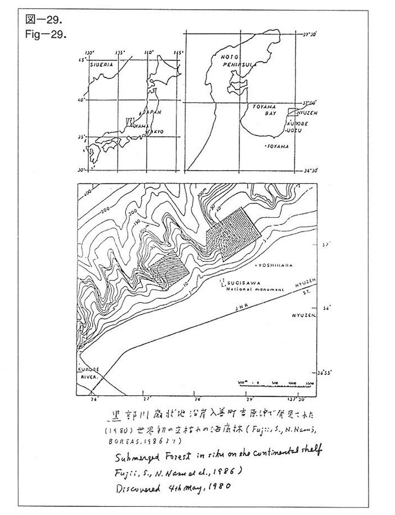
گ}پ|29. ‘ه—¤’I‚ھ‚©‚آ‚ؤ—¤’n‚إ‚ ‚ء‚½‚±‚ئ‚ًڈط–¾‚·‚éگ¢ٹEڈ‰‚ج—§‚؟Œح‚ê‚جگX—ر‚ج”Œ©ٹCˆوپB“ْ–{ٹC‚ة–ت‚µ‚½•xژRŒ§چ••”گىگîڈَ’n“ü‘P’¬‰«پBگ…گ[–ٌ20mپ`40mپB1980”N5Œژ4“ْچإڈ‰‚ج”Œ©پB(Fujii, S., Nasu, N. et al .,1986(‰p•¶))
Figپ|29. The discovery of submerged forests in situ to prove that the continental shelves were once to be the land. The location is off the coast of Nyuzen Town along the shore line of Kurobe River Alluvial Fan, Toyama Prefecture facing the Sea of Japan. The tree trunks distribution depth ranging about 20mپ`40m. The first discovery was made in 4th May, 1980. (Fujii, S, Nasu, N. et al., 1986)
پiٹg‘ه‰و–تپF 141 KBپj
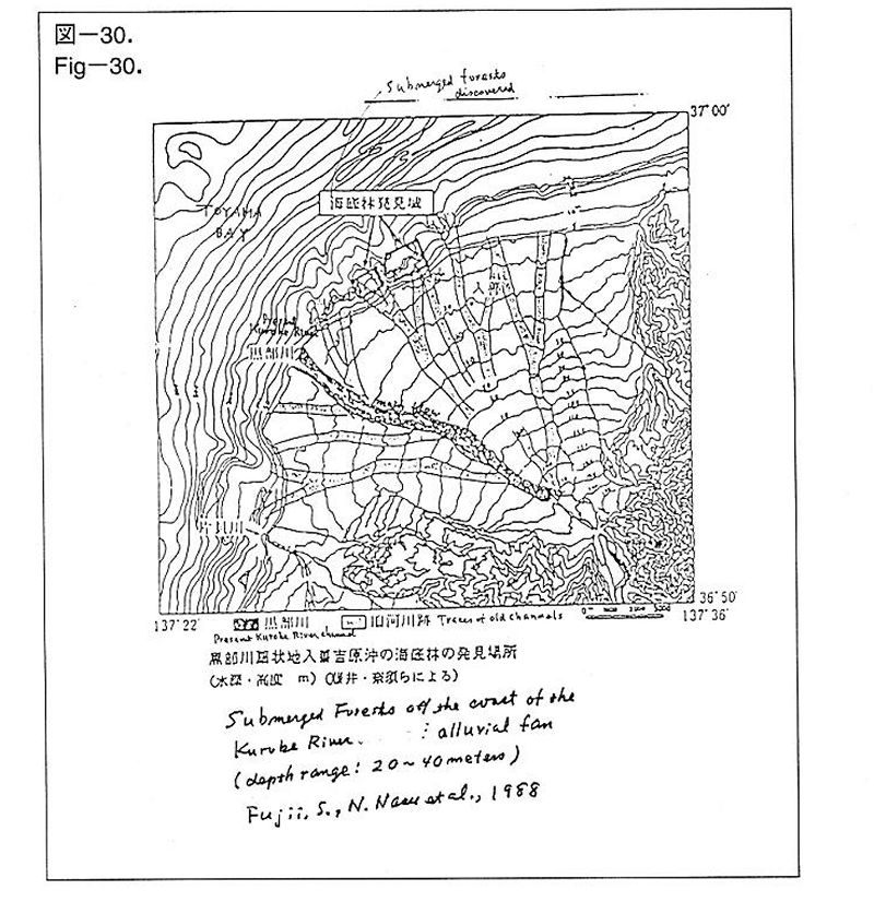
گ}پ|30. چ••”گى‚ج—¬کH‚حگîڈَ’n‚جڈم‚ًپAژه‚ئ‚µ‚ؤچ^گ…‚ًŒ_‹@‚ئ‚µ‚ؤ•د‘J‚µ‚½(“،ˆنڈ؛“ٌپE“قگ{‹IچK‚çپA1988)
Figپ|30. Main flow channel of Kurobe River has been often migrated according to floods (Fujii, S., Nasu, N. et al., 1988 (in Japanese))
پiٹg‘ه‰و–تپF 44 KBپj
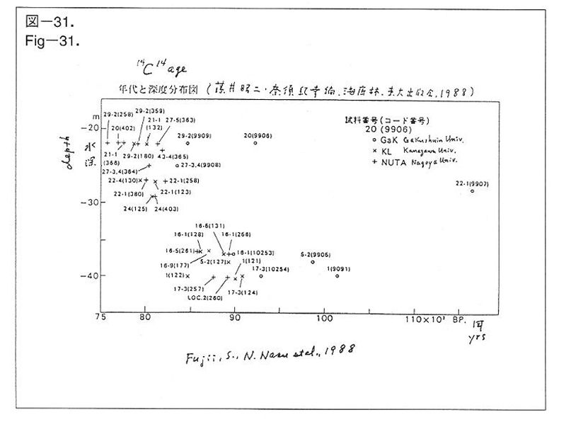
گ}پ|31. چ••”گىگîڈَ’n“ü‘P’¬‰«ٹC’ê—ر‚جگ¶‘¶ٹْٹش‚ح’Y‘f14–@‚ة‚و‚é”N‘م‘ھ’è‚ة‚و‚é‚ئپA7000پ`10000”N‘O‚ة‚ب‚éپBگ…گ[20m•t‹ك‚ج‚à‚ج‚ھ–ٌ8000”N‘OپAگ…گ[40m•t‹ك‚ج‚à‚ج‚إ–ٌ9000”N‘O‚ھ’†گS‚ئ‚ب‚éپB(“،ˆنڈ؛“ٌپE“قگ{‚çپA1988)
Figپ|31. Ages of the submerged forests off the coast of Nyuzen Town at the edge of Kurobe River Alluvial Fan measured by 14C age determination method.پ@The range covers 7,000پ`10,000 years ago.پ@Trees depth around 20m are mainly about 8000 years old, and those depth around 40m are mainly about 9000 years old (Fujii, S., Nasu, N. et al., 1988 (in Japanese))
پiٹg‘ه‰و–تپF 128 KBپj
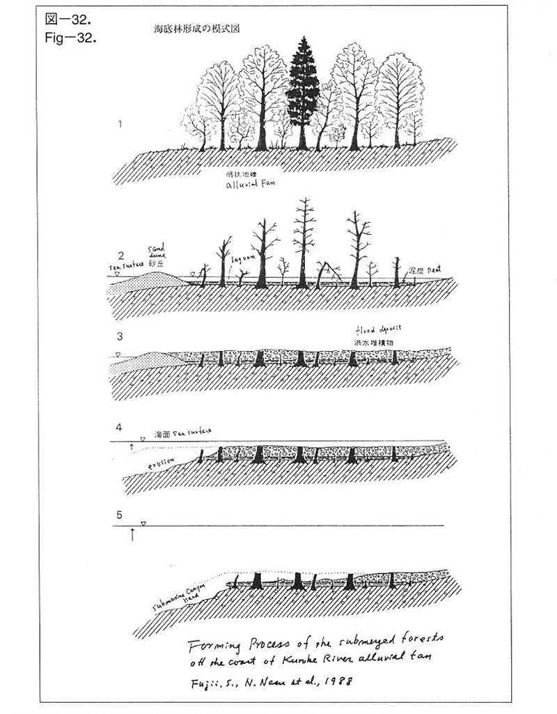
گ}پ|32. چ••”گىگîڈَ’n“ü‘P’¬‰«ٹC’ê—ر‚جŒ`گ¬‰ك’ِپB(“،ˆنڈ؛“ٌپE“قگ{‹IچK‚çپA1988)
پ@–{•¶‚ًژQڈئ‚³‚ꂽ‚¢پB
Figپ|32. Forming Processes of the submerged forests off the coast of Nyuzen Town at the edge of Kurobe River Alluvial Fan (Fujii, S., Nasu, N. et al., 1988 (in Japanese))
پ@Please read the main explanation sheets.