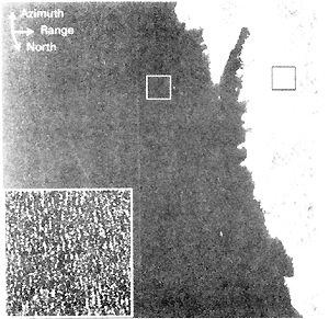
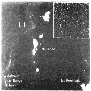
Figure 2: JERS-1 SAR image (50 x 50 km) of the Sanriku coast (left) and that (60 x 60 km) of the Izu islands (right) with enlarged (3.2 x 3.2 km) wave images.
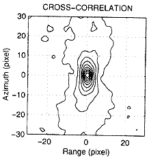
Figure 3: The contour plot of the cross-correlation function over the black-boxed area in the Sanriku image to ensure the correct inter-look co-registration.