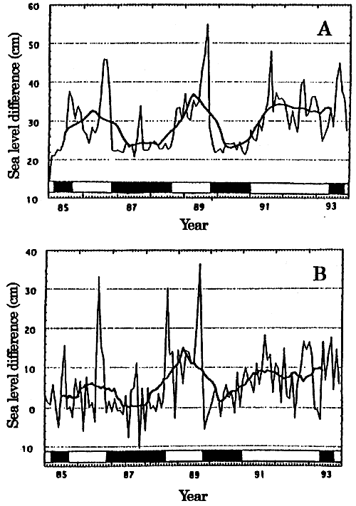
Fig.2. The variations of the sea level difference between two tide gauge stations at Kushimoto and Uragami (upper figure: A) and those between two oceanic observation stations. Stas. 25 and 31, of Wakayama Prefectural Fisheries Experimental Station (lower figure: B) during the period from 1985 to 1993 (Fujita, 1997; Sekine and Fujita, 1999). Thin line in A indicates the bimonthly averaged value and that in B at each observation time (the stations are occupied basically once a month). Bold lines are the 12.5 months running averaged curves. The black bars and white bars shown in the both figures indicate the times of the large meander and the straight path of the Kuroshio, respectively.
The main results are:
(1) The transition from the straight path to the large meander path occurs usually abruptly. It has been believed that small-scale meanders of the Kuroshio generated often near the southern tip of Kyushu travels eastward along the south coast off Shikoku and Honshu, and that some of them develop abruptly just after they pass by Cape Shionomisaki and form the steady Kuroshio Large Meander off Enshu-nada (see Fig.3 for these locations).