FLOW NATURE OF THE KUROSHIO IN THE VICINITY OF THE KII PENINSULA AT THE TIME OF THE STRAIGHT PATH OF THE KUROSHIO (JUNE 11-14, 1996)
The dense CTD and XBT observations were carried out in the Kuroshio area in the vicinity of Cape Shionomisaki, the tip of the Kii Peninsula, on board the R/V Seisui-maru of Mie University on June 11-14, 1996.
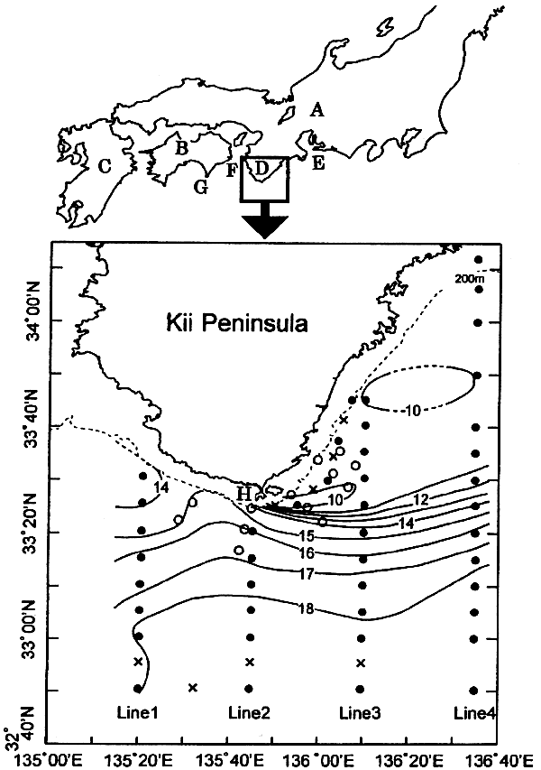
Fig.3. Observation sites of the R/V Seisui-maru of Mie University on June 11-14, 1996 and of the R/V Wakayama of Wakayama Prefectural Fisheries Experimental Station on June 11-12. The CTD observation points by the R/V Seisui-maru and by the R/V Wakayama are indicated with black circles and white circles, respectively, and the XBT observation points by R/V Seisui-maru with ×. The horizontal temperature distribution (in ℃) at 200 m depth is also shown (Nagata et al., 1999b). A: Honshu, B: Shikoku, C: Kyushu, D: Kii Peninsula, E: Enshu-nada, F: Kii Channel, G: Cape Muroto, and H (lower figure): Cape Shionomisaki.