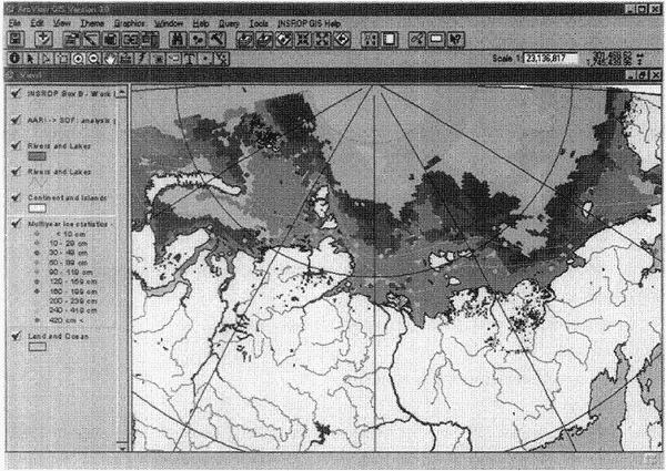
Figure 4.6-2 Example of INSROP GIS data display (average ice-thickness distribution in January)
丂
[4] Oceanographic and river data
The following data are registered.
a. Tidal data
Average flow speed and azimuth angle are stored, utilizing the data on current measurement with moored buoys at depths of 5-10m in summer from 1956 to 1995.
b. River flow
Monthly average flow rates of selected Siberian rivers are stored.
c. Seawater density
d. Seawater salinity
[5] Navigation data
The segmented navigation data in the NSR are provided on the coordinates (longitude and latitude). Sea depths and distances between the coordinate-points are also registered.
[6] Infrastructure
These data include maps of major roads and railways and congested districts.
[7] Environmental geography
Biological data, gathered for use in environmental impact assessment, are stored. These include distributions of populations of mammals such as polar bears as well as birds and fish.
丂
4.6.4 Application Examples
GIS is a powerful and flexible database application with proven value in a wide range of applications, but requires extensive practice to use the system properly. Even though INSROP GIS comprises a simplified menu for the NSR, it is almost impossible for beginners to perform all the specified analyses in the GIS. Although the GIS users' manual affords a detailed guide for operation and applications in practice, an example of the analysis performed by INSROP GIS is presented for better understanding: extracting ice data along a given route.