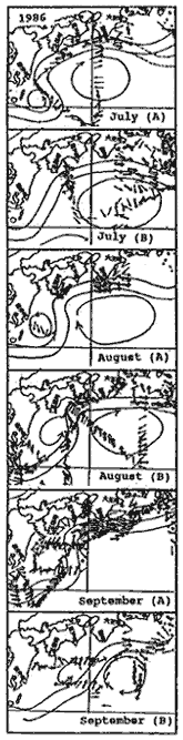
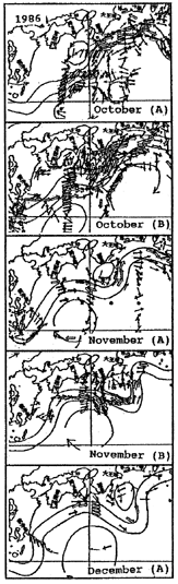
Fig. 3 Variation of the Kuroshio path to the south of Japan in the period from July to December, 1986 (cited from the Prompt Report of Oceanographic Condition). (A) indicates the first half of the month and (B) the second half of the month. The arrows indicate surface current vectors measured by GEK. The distribution of the arrows demonstrates roughly that of the oceanic observations in each period.