Figure 4:丂Currents during the 3. year of integration in the deepest layer with contours of bottom topography. The maps show a 10亱by 10亱area center at 70亱 at the equator. Only every 9th vector is shown. Contour interval is 200m.
丂
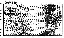
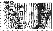
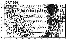
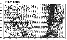
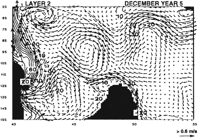
Figure 5:丂Currents in layer 2 after 5 years of integration. Eddies are generated by intense flow past the northern tip of Madagascar. Contours show the thickess anomaly (m) in the layer. Only every 9th current vector is shown.