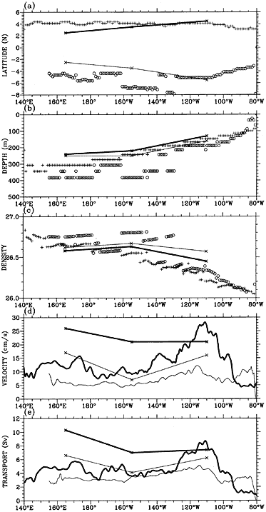
Figure 4: Latitudes (a), depths (b), potential densities (c), maximum velocities (d) for the SCCs' cores, and transports of the SCCs as a function of longitude. Plus (a, b, c) and thick lines (d, e) for the NSCC, and circles and thin lines for the SSCC. The estimates from hydrographic observation at three longitudes (165。?, 155。?, 110。?) are also included with asterisks and thick line (NSCC) and crosses and thin lines (SSCC).