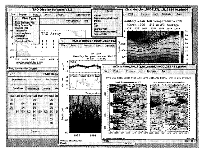
Fig. 2. TAO display software provides point-and-click access to real-time and historical TAO data in the Unix/X-windows environment, with data updates provided on the Internet by an automated data subscription service.
I. INTRODUCTION
The TAO array (Fig. 1; Hayes et al., 1991; McPhaden, 1993) is a major component of the global climate monitoring system. consisting of approximately 70 moored buoys, spanning the Equatorial Pacific Ocean from 95xW in the eastern Pacific to 1305E in the west, and telemetering atmospheric and oceanographic data in real time to shore-based computers via the NOAA Argos satellite system. Supported by an international consortium involving cooperation between the United States, Japan (JAMSTEC), Korea, Taiwan, and France (ORSTOM), the TAO array measures oceanographic and surface meteorological variables critical for improved detection, understanding, and prediction of seasonal-to-interannual climate variations originating in the tropics, most notably those related to the El Nino/Southern Oscillation (ENSO).
Originally developed under the Tropical Ocean Global Atmosphere (TOGA) program, the TAO array is presently being maintained in support of programs such as the U.S. Global Ocean Atmosphere Land System (GOALS) program, the World Climate Research Program's study of Climate Variability and Predictability (CLIVAR), the Global Ocean Observing System (GOOS), and Global Climate Observing System (GCOS). The TAO Project Office is located at NOAA's Pacific Marine Environmental Laboratory in Seattle, Washington, and is fully described in the TAO home page at http://www .pmel.noaa.gov/toga-tao/.
The TAO buoys are constructed and the sensors are calibrated at PMEL (Mangum et al., 1994). After deployment, the buoys transmit data to a shore-based computer via the Argos satellite system. The data is acquired and processed nightly at PMEL (Soreide et al., 1992). TAO data is made available to thescientific community by a variety of methods. including an Internet anonymous ftp data base, and yearly submissions of the data to the National Oceanographic Data Center (NODC) in Washington, DC, the National Climate Data Center (NCDC) in Asheville, North Carolina, and the TOGA Subsurface Data Center in Brest, France. Scientific utilization of the moored measurements has also been encouraged by the development at PMEL of sophisticated data management and dissemination capabilities. These include the TAO Display Software (Soreide et al., 1995), which is a user-friendly, Unix- based interactive data display and analysis system with an automated data subscription and update service, and distribution of TAO data and analyses through the World Wide Web (Soreide et al., 1994), utilizing interfaces such as Netscape (http://w ww.pmel.noaa.gov/toga-tao/realtime.html).
II. TAO DATA DISTRIBUTION
The TAO data distribution includes both real-time and historical TAO buoy data; (1) surface meteorological data, including wind, air temperature, and relative humidity, (2)subsurface temperature, current meter, and ADCP data, (3)