|
3. DISPLAY DESIGN
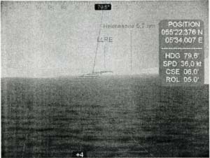
The design of the HOTS display itself has emerged over a period of time with the first initial designs and tests conducted in AUC's experimental HSC simulator m early 1999 (Fig. 2)
Fig.2 Initial HOTS display design
This prototype diplay was designed as a compromise between computing power and rendering capabilities. A double Pentium II 300 MHz equipped with an Quantum3D Obsedian 100SE served as hardware platform, whilst the software was based on OpenGVS and OpenGL. Due to the limitation in computing power the terrain was implemented as an two-dimensional (2D) silhouette and not as an complete three-dimensional (3D) terrain model. Either not was navigational information extracted from C-Map implemented.
The display design was and is a compromise between including enough information for the pilot to perform the driving task and at the same time prevent excess clutter of the display. The operator of the display can turn on and off augmented information in proportion to the needs required by the visibility conditions.
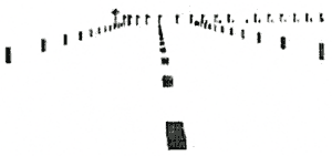
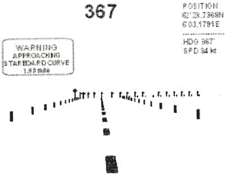
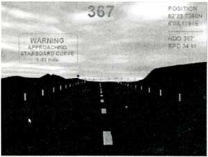
The appearance of the current display has emerged over several stages from the early initial designs of 1999 until the design of today. The baseline of the current display is intentionally designed to resemble the marking of an automobile highway with edge marking, centerline marking, marking of curves and warning signs (Fig. 3) In addition, virtual billboards is used to give the navigators additional information (Fig. 4).
Fig.3 Baseline of display
Fig.4 Baseline and virtual billboards
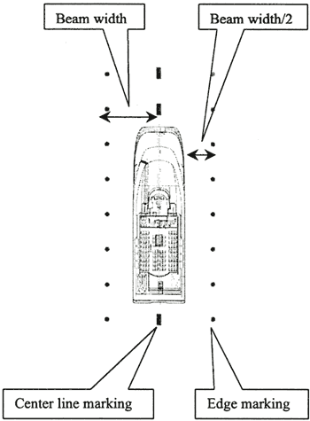
Contrary to a normal highway the centerline in this display indicates the optimal driving path of the vessel. The distance between the outer edge markings is set in relation to the width of the hull. The distance is equal to the beam width of the vessel from the centerline to the edge of the virtual road. This gives a clearance of half the beam width from the beam end to the edge marking (Fig. 5).
Fig.5 Pathway dimensions
To further enhance the display, the system also includes a 3D terrain database. The 3D terrain was added to give the navigators information regarding to local terrain. This information is not a necessity if the navigators always keep the vessel on track, but it will provide vital information if they have to deviate from the ideal trajectory.
Both wire frame and textured terrains have been tested on an experimental basis without any scientific measures of performance improvement or degradation. This will be the subject of future studies(Fig. 6).
Fig.6 |
HOTS overlaid on textured 3D terrain model |
In the latest implementation of HOTS sound warning cues are also implemented. Sound warnings in form of both synthetic sounds and spoken warnings have been tested without scientific evaluations. If there is deviation from the centerline pathway the navigators attention is called upon through repeated short beep's or a woman's voice saying "Pull Port" if the deviation is to starboard side, and through repeated long beep's or a woman's voice saying "Pull Starboard" if the deviation is to port side.
|