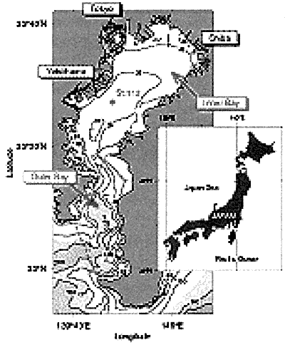
FIGURE 1. Bottom topography in Tokyo Bay. Bottom depth contours are in metres. Station 112 indicates a hydro-cast station.
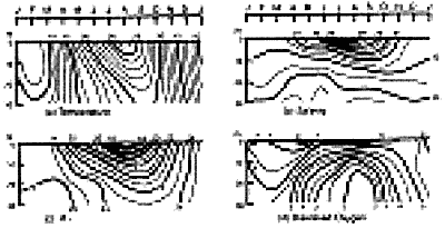
FIGURE 2. Annual changes of vertical distribution near the centre of Tokyo Bay: (a) temperature (℃), (b) salinity, (c) density (σt,) and (d) dissolved oxygen (ml 1-1) (after Unoki, 1993).
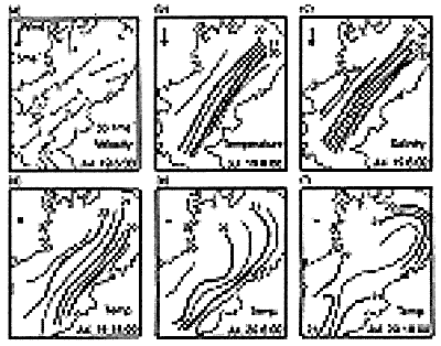
FIGURE 3. Horizontal distributions of result of TOBEX: (a) velocity (solid and dashed arrows show velocity at the depth of 3 m and at the depth of 5 m above the bottom, respectively), (b) temperature (℃) and (c) salinity at 3 m depth, at 06.00h on 19 July 1 979. (d) temperature distribution at 3 m depth at 18.00h. on 19th, (e) at 06.00h. on 20th and (f) at 18.00h on 20th (after Unoki, 1993).
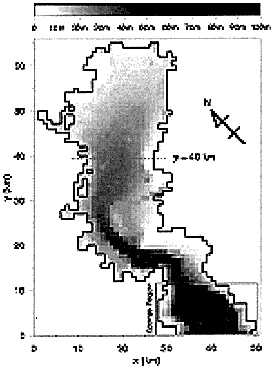
FIGURE 4. Schematic view of the model ocean. The sponge region is imposed at 0<y<12 km. The dashed line shows the transverse section y=40 km shown in Animations 2 and 4.
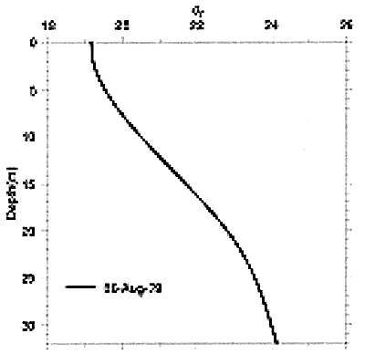
FIGURE 5. Basic density (σt stratification at Station 112 shown in Figure 1 on 16 August 1979.
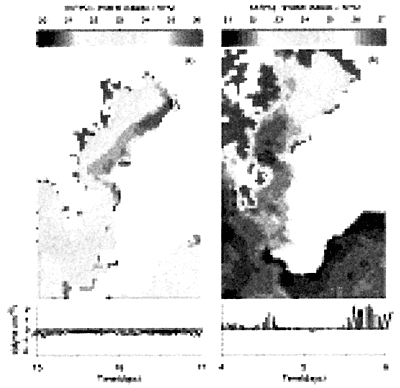
FIGURE 6. Sea surface temperature around Tokyo Bay from NOAA-AVHRR on (a) 16 August and (b) 5 September 1991. The area of albedo over 10% are not drawn because of land or cloud. Time variations of 3-hour averaged wind stress measured at Tokyo Light Beacon are also shown in the bottom of each panel.