Eventually the hunt widened to include marine mammals other than whales, as well as reindeer. From humble beginnings as a subsistence way of life, whaling and other Arctic hunting grew in quantity to become the basis for barter, and ultimately of full-fledged trade.
丂
Seafaring skills in the Age of Commerce
Two of the most important tools used by 16th-century seafarers were the compass and the astrolabe. Using log lines, and given the speed of the vessel, they could ascertain the rough longitude of the craft in a technique called dead "reckoning." The astrolabe was employed to determine latitude with remarkable accuracy. With the aid of a table of the sun's declination over the course of a year and a simple tool called a cross-staff, even more accurate measurements could be obtained. This method of determining position by the angle of the sun has a long pedigree; the solar declination tables are said to have been calculated originally by the Arabs. In the mid-13th century King Alphonso X of Castile introduced these tables into Christendom, and to this day they are still known in the West as "Alphonso's tables."
丂
The Portalano Chart
The oldest of the Portalano Chart dates back to the 1300s. Their astounding degree of completeness suggests that these maps were continually redrawn and corrected over successive generations. The "Normal Portalano" is an exquisitely beautiful piece, drawn on vellum with colored ink. The Mediterranean and Black Seas and the coastlines of western Europe and northern Africa are rendered in painstaking detail, while the inland areas are almost completely blank.
丂
Hand-drawn charts
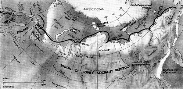
Extending their range of navigation in search of new resources, seafarers had to adapt not only the ships themselves but also the ways in which they lived their lives aboard their vessels in the icy polar seas. Great strides were also seen in the art of navigation, informed by hard experience. During this period the seafarers drew maps by hand, building the foundations of the craft of mapmaking in the Age of Navigation. The antecedents of this impressive art reach as far back as the Portalano Charts of the Middle Ages. These ancient maps displayed a far greater accuracy than the first maps produced on a printing press, which reflected a Ptolemaic world-view and symbolized the power structure prevalent in medieval times. It was the Portalano Charts that influenced and guided the seafarers of the northern seas.
丂