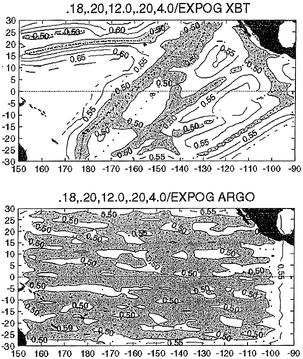
Figure 5. Error maps (℃) for near-surface temperature fields estimated from optimal interpolation based on statistics gathered from well-sampled XBT lines. The upper panel is for the NOAA XBT sampling in the eastern tropical Pacific during January-February 1998. The lower panel is for a random array with average spacing of 3°in latitude and longitude.