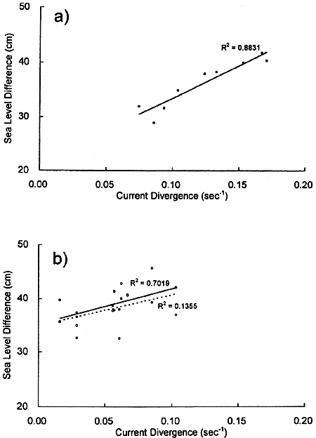
Fig.8. Correlation between the hourly value the sea level difference between Kushimoto and Uragami and the current divergence averaged over the central portion of the standard line. (a) At the time of the repeated runs in Cruise II. The regression line is shown with full line and the square of the correlation coefficient is shown in the figure. (b) At the time of the repeated runs in Cruise III: white dots indicate the case that the raw value of the sea level difference is taken in the ordinate, and black dots the case that the sea level difference has been used after elimination of the tidal signal (see Fig.14). The regression lines are shown as a dashed line (R2 = 0.14) and a full line (R2 = 0.70), respectively.
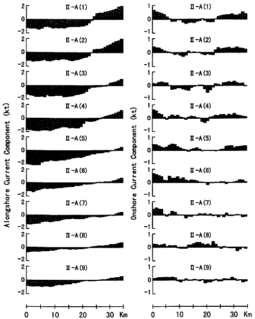
The decreasing trend of the divergence value can be clearly seen in this table.
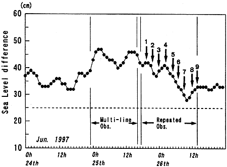
The temporal variation of the hourly value of the sea level difference between Kushimoto and Uragami during the period of Cruise II is shown in Fig.7. It is interesting that the sea level difference also tends to decrease during the repeated observations. The correlation between the current divergence and the sea level difference is shown in Fig.8(a). It is clear that the current divergence increases with increasing sea level difference. Though we have no information connecting the hourly sea level difference to oceanic states such as the position of the Kuroshio axis (we investigated satellite image data, but we could find no image clear enough to identify the Kuroshio axis even for the daily bases in this period), the good correlation seen in Fig.8(a) suggests that the hourly values of sea level between Kushimoto and Uragami represent some oceanic status in the vicinity of the Kii Peninsula.