Maps of ice conditions were also prepared according to international standards; as an example, the map of ice conditions in the East Siberian Sea is shown in Figure 5.6. The mission experienced navigation in icy waters for only 6.5 days, including a smooth voyage in the presence of sparse small ice floes. No level ice or vast uniform ice floe was encountered. With the aid of image-processing, the records captured by the video cameras mounted on the ship provided the data of ice concentration and ice thickness, which were then carefully examined and compared with the visual observations mentioned above.
[4] Through close liaison with Norway's Nansen Environmental Remote Sensing Center (NERSC), the Kandalaksha obtained a continuous feed of two types of satellite image from this laboratory during its voyage. One type of image was delivered from the synthetic-aperture radar (SAR) mounted on the ERS-1, a European satellite used in exploration for natural resources. These images delivered superb spatial resolution, but covered relatively narrow swaths of about 100km (see the example in Figure 5.7). The other series of images was captured by a Special Sensor Microwave Imager (SSM/I) belonging to the US National Ocean and Air Agency (NOAA) and transferred to NERSC for interpreting of the data into ice mapping. Although the spatial resolution of the SSM/I images was lower than those from SAR, the data covered a much wider area. These ice maps were transmitted to the ship by facsimile via the INMARSAT communication satellite. The same telephone line was also used to provide an Internet connection that delivered the original images with high quality. The locations at which these satellite images of ice conditions were taken and each coverage of SAR and SSM/I data are shown in Figures 5.8 and 5.9. The SAR sensor installed in the Canadian RADARSAT satellite which provides a maximum observation swath of 500 km, is expected to be highly effective in the NSR. For the moment, however, these images are extremely expensive.
The Kandalaksha benefited from other sources of ice data as well. The Maritime Operation Headquarters at Pevek and Dikson provided the Kandalaksha with two types of data on ice conditions. One type consisted of numerical flight reconnaissance data sent from Pevek by telex. One of the Russian experts of the mission team analyzed the data to create ice maps. The other source of data, obtained from the Dikson Headquarters, was a hand-drawn ice map based on data from the Russian OKEAN-1 observation satellite.
丂
丂
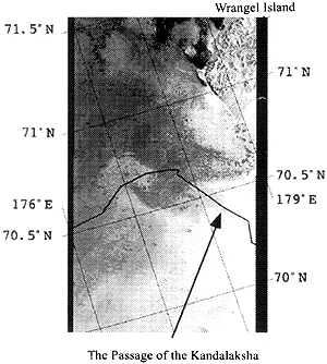
[5] Discussions and decisions about the ship's specific route were based on these data on ice conditions. Because this voyage followed a more northerly route than usual, the SAR image data were unfortunately of almost no use in determining the ship's route. This is because the time and position of the images captured by the SAR have to be booked months in advance. Compensating for this loss was the great utility of the SSM/I images and the Russian ice maps, which were instrumental in enabling the ship to voyage in the north of Severnaya Zemlya without icebreaker escort.