4. FEATURES
丂
4.1 GIS Technology
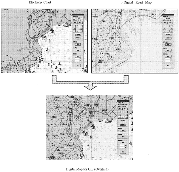
The GIS technology is one of the most important factors to realize the transportation management system. The various data of the ships and trucks such as positions and status are managed together. The latest position of ships and trucks are displayed on the digital map with the symbol mark simultaneously. We developed the unique function to overlay the digital road map on the electronic chart. We applied "JMC map" published by Geographical Survey Institute as a digital road map and the ENC (Electronic Navigational Chart) published by Japan Coast Guard as an electronic chart.
In this system, the digital road map data, which are important for the management of the vehicles, are transferred to Mercator's data, and is displayed and overlapped on electronic chart. Fig.4 shows a sample of the overlaid display screen.
When using to this overlaid display function, the system user can display the required both positions of the ships and trucks without transferring the map and the chart. So positions of ships and trucks are displayed on the same screen simultaneously.
丂
Fig. 4 Screen image of the overlapping function of the digital chart and digital road map