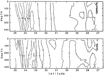
Fig. 3丂Mean flow section, E-W (N-S) component is shown in upper (lower) panel. Westward (southward) flow area is shadowed.
丂
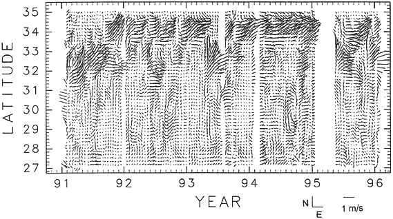
During the period, the Kuroshio took the bimodal paths of 34-00N and 32-30N as mean position on the ship course. The peak of the flow is seen around 34N, the Miyake Island. As the Kuroshio fluctuated north and south, that the local maximum is seen around 32-30N, near the Hachijo Island (Fig. 3). The former (northern path) is corresponding to the large meander path and/or the onshore non-large meander path, and the latter (southern path) is corresponding to the offshore non-large meander path.