日本財団 図書館


100-1.gif

4. ICE DISPLACEMENTS


Using RADARSAT/SCANSAR images of 15 and 22 December 1996, we calculated ice motion on the upper-right (northeast) quarter of the squares of Figure 1. Ice moved roughly about 13 km/day westward with noticeable deformation (Figure 3). Both divergence and shear were large in the upper-right and lower-left parts of Figure 3 where strong deformation can be seen. The lower-left part of Figure 3 is close to the edge of the land-fast ice where see is less than 20 m deep. The upper-right comer of Figure 3 is over 50 m deep on the shelf-break. There is apparent relation between the sea-ice deformation and the bottom topography.

100-2.gif

5. Futre plan


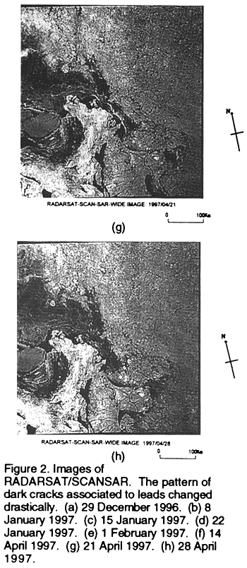
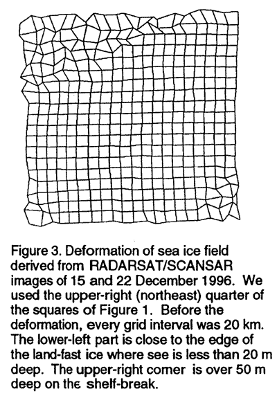
We plan to discuss the displacement and deformation of the sea-ice field observed by RADARSAT/SCANSAR weekly from December 1996 through April 1997.


REFERENCES


Fily, M. & Rothrock, D. A., 1987: Sea ice tracking by nested correlations.

IEEE Trans. Geosci. Remote Sensing, vol. 25, no. 1, 570-580

Flato, G. M. & Hibler, W. D., III, 1992: Modeling pack be as a cavitating fluid. Journal of Physical Oceanography, vol. 22, 626-651

Kwok, R., Curlander, J. C.McConnell, R. & Pang S. S., 1990, An ice-motion tracking system at the Alaska SAR facility., IEEE J. O.ceanic Eng., vol.15, no.1, 44-54


BACK   CONTENTS   NEXT


日本財団図書館は、日本財団が運営しています。

  • 日本財団 THE NIPPON FOUNDATION