|
BASIC DATA - BANG SAPHAN (PRACUAP) PORT
1. GENERAL
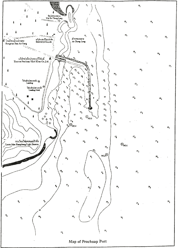
Bang Saphan is formally know as Prachap Port located at the Guld of Thailand at 1111' N 99.36' E. The port layout is shown in the figure attached.
Approach to the port is via 1400 m long with 250 width channel dredged up to -15 m LLW. The port is equipped with navigational assistance, communication system and pilot service for 24 hours. The total port areas are about 64 ha.
Bang Saphan port is managed by Pracuap Port Co., which is affiliated company of Sahaviriya Group.
2. BERTH FACILITES
There are 2 wharves of which NO.1 with length of 450 m and width 30 m, and NO.2 with length of 245 m and width 25 m. The wharves can accommodate up to 100,000 DWT vessels for NO.1 and up to 20,000 DWT for NO.2.
3. PORT EQUIPMENT
The port equipped with mobile cranes, folk lifts, trucks, and trailers.
4. PORT HINTERLAND CONNECTIONS
The port is originally constructed to support logistic of steel and metal products of Sahaviriya group established and operated nearby.
5. CARGO THROUGHPUT
Main cargo handling is steel products, in addition minerals, cement, rubber, fartilizer, tapioca and other general cargoes.
6. PORT DEVELOPMENT PLAN
The port has the plan to develop West wharf with length of 600 m which can receive 3 vessels with their capacity of 10 to 30,000 DWT simultaneously.
Further as the long-term development plan, construction of deep sea wharf for 4 vessels with their size of 150 to 200,000 DWT.
Map of Prachuap Port
BASIC DATA - THA TONG (SYURAT THANI) PORT
1. GENERAL
Tha Tong port is the inland local port of Surat Thani.
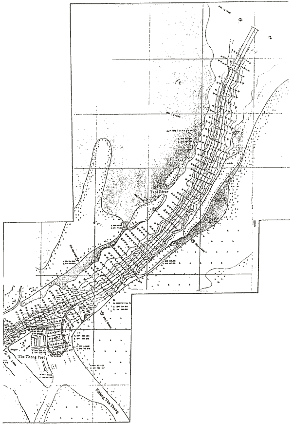
Approach to the port is via 35 km long with narrow 60 m width channel dredged up to - 4 m LLW.
The port layout is shown in the figure attached.
2. BERTH FACILITES
There are 2 wharves with length of about 100 m length and 13.6 m width.
The wharves can accommodate up to 1,000 GT vessels.
Map of Tha Tong Port and Navigation Channel
|