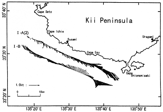
The current profile (1-B:Fig. 18) along the line 5 km offshore of the standard line, which was taken about 2. 5 hours later, is rather similar to that taken at 50 m depth in I-A(1) about one day before:the strong westward flow is seen off Cape Shionomisaki, but the remnant part may be classified into the Kii Bifurcation Current.
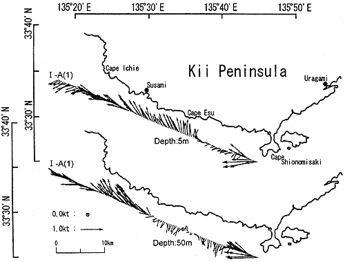
Though the available data are limited, it seems to be clear that the current situation in the vicinity of Cape Shionomisaki in Cruise I was very variable both in time and space, and was quite different from those in the other three cruises.